Integrated Discrete Environmental Analytics System (IDEAS)
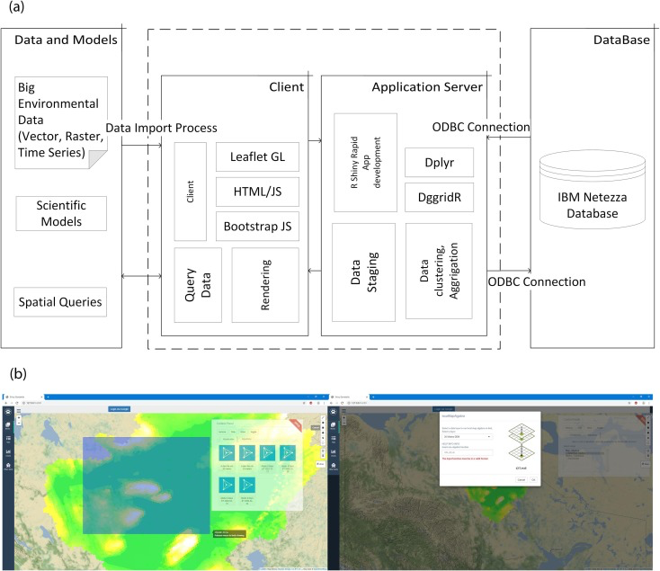
This multi-year project developed a new approach to geospatial data representation, storage, and analysis. We combined an analytics data warehouse with a discrete global grid geospatial data model to create a new analytics system for large-scale environmental data analysis. Several demonstration analyses and case studies have been deployed on the system including a flood risk mapping app and related paper, and a wildfire simulation study.